3 Snowshoeing Trails Around Park City
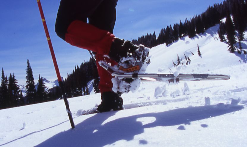
Want to strap on those snowshoes and head out for a trek, but need some advice on where you should go? Here are a few routes worthy of your snowshoeing adventures!
Heartbreak Hill
This steep 1.5-mile Iron Mountain trail climbs through massive aspens and conifers. Though reaching the actual Iron Mountain Peak is ill-advised given avalanche danger, the along-the-way overlooks before reaching Mid Mountain Trail (8,150 feet) offer expansive views and, more important, time to catch your breath. Prepare to leap out of the way of gleefully and rapidly descending joyriders on Swiss Bobs (shovel-like sleds).
Park and start: Take Payday Drive off of Park Avenue (S.R. 224), then turn right on Iron Canyon Drive. Head uphill until you reach Iron Canyon Court and turn right. The trailhead is at the end of the cul-de-sac, but parking is on the lower west side of the street between signs.
Easy Does It
Gently wind your way from the Quinn’s Trailhead through a small section of the 1,200-acre Round Valley trails to summit this smack-in-the-middle hill. The “PC” (yes, it stands for Park City) sits on the south-facing side, which typically has sparse snow. So, stick to the backside and take in 360-degree views of town and the slopes at 7,200 feet. Don’t be afraid to continue the adventure through the vast trail system surrounding this easy, 45-minute, out-and-back climb.
Park and start: Take Round Valley Way off of Kearns Boulevard, then the immediate sharp left onto Gillmor Way. Once the road takes a sharp right, park in the second parking lot on the right, across the road from the Quinn’s Trailhead marker.
Southern Exposure
Follow tracks forged by backcountry skiers for a vertical, hour-long, out-and-back jaunt along the Over Easy Trail. From the ridgeline, soak in views of Lamb’s Canyon, Alta, and Snowbird. If the path to Summit Slam is clear (or a local happens to be there to act as a guide), take it. Otherwise, relish the downhill return—with or without the benefit of a sled.
Park and start: Take the Summit Park exit off of Interstate 80 westbound and turn left to drive under the freeway; then, take a right onto Aspen Drive and the first left onto Parkview. This steep, windy road eventually dead-ends into angled parking (given the tight curves and inclines, four-wheel drive vehicles are a good idea) at the Summit Park Trailhead.
Snowshoeing has all the inherent risks of any backcountry adventure. Map out your trail (mountaintrails.org, basinrecreation.org, or Map My Hike app); know the avalanche risks (utahavalanchecenter.org); bring water, food, and appropriate clothing; respect local wildlife; hike with a buddy; and let someone know where you’re headed.